Thursday, July 20, 2017

Driving to St. John's

The drive from St. Anthony to St. John's is roughly 1050km and 11 hours without stops. Who in their right mind would take on that trek especially after having gotten up early on drive day to take an iceberg tour? Well certainly not us, even we aren't that crazy despite some of the lengthy drives we've had on this trip. We broke the drive up with two stops in between. We did end up driving back on the Viking Trail because there is no other road on the east side of the peninsula where St. Anthony is located that brings you to St. John's. St. John's is on the most easterly side of Newfoundland. Seemed a little strange but if you see how remote and rugged the trrrain is between most of the towns, it's understandable that the fastest route was to double back. This gave us the opportunity to be on the coastline side as we drove through all the small fishing villages and through Gros Morne National Park. 

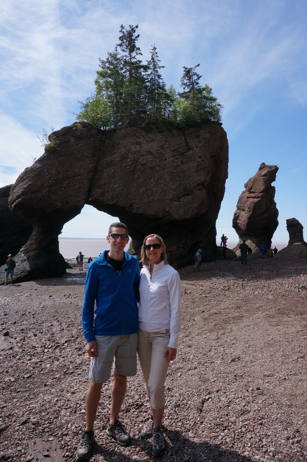
Our first stop was in Springdale; still a long 6 hour drive from St. Anthony. Because our tour had been delayed it did get us on the road a little later than we originally planned so we didn't have time to stop in the park to do any hiking. We pretty much just drove straight through. With such long driving time swapping drivers is key to ensuring one doesn't get too tired potentially putting both of us in danger. It all worked out and I figured out that I'm best at driving in the morning than in the afternoon.the Viking Trail, or route 430 brought us to Hwy 1, or TCH as they seem to sign it in Newfoundland, in The community of Deer Lake. From there we continued on to Springdale, our stop for the night. Along this journey we once again saw a moose, this time on the side of the TCH. This one had the full antlers and ended up running back into the forest after being scared off from the traffic noise. I was driving at this point and could see him a ways down the road. He was very pronounced and not difficult to see; quite the large creature. 

In Springdale we stayed at a fairly new inn nestled along the Indian River. This was a great little stay even if it was for only one night. We had a river view from our room and in the morning we went for a nice walk on a trail beside the river. We saw a couple local men wading out of the river with their morning salmon catch. Guess what they might have been having for dinner that night. There river also spared to be a great place for bird watching. After our morning walk we set out to keep on schedule to get to St. John's. from Springdale to St. John's is another 5.5 hour direct drive. But we of course decided that taking the long way around and detouring ourselves completely out of the way to Bonavista would be the way to go. So instead of that 5.5 hour drive we drove just shy of 5 hours to Bonavista. This drive took us through Terra Nova National Park. Throughout our entire travels we had no issues outside of missing half of the Cabot Trail due to a motor vehicle accident. Our luck changed in Terra Nova National Park through no fault of ours. We were driving along when a truck travelling in the opposite direction threw a rock in the air which struck our windshield and caused a sizeable ding. So unfortunate because now we would have to deal with this upon returning the vehicle. 

We arrived in Bonavista early afternoon which gave us plenty of time to see the sights. We stayed at the Harbour Quarters Inn, a heritage inn built in circa 1920 and restored in 2004. Each room is furnished with locally made furniture and the inn is located right in the harbour. Looking from the property to the North Atlantic, we could again see an iceberg floating by. Our first sightseeing stop was the Ryan Premises, a national historic site. The significance of this site was learning about the local fishery which influenced settlement, culture and economic development on the east coast for more than 500 years. The site consists of 5 separate building, each showcasing different exhibits pertaining to the fishery and life as both a fisherman and a fish merchant. 

Bonavista is thought to be where John Cabot first spied land in the New World during his 1497 voyage from Britain. It's his report of abundant cod stocks that enticed centuries of English and Irish settlers to fish there in the summer months. On the road to the town's lighthouse, you can find a large statue of John Cabot on a hill overlooking the sea. Cape Bonavista lighthouse was first lit in 1843. The life of a lighthouse keeper was a difficult, yet extremely important, one with gruelling long hours. From the lighthouse we followed the main road to The Dungeon. This is a massive collapsed sea cave formed by the restless pounding of the North Atlantic waves against this rock formation. You can get some good views of the dungeon up close, but be vary of the signs that indicate that should you fall in it is difficult to get out. 

From there we venture to our last sightseeing spot. Z said he wasn't leaving Newfoundland until he saw a puffin and he was serious. We ventured out to a somewhat remote area about 20 minutes away where he read that he was guaranteed to see puffins. Fingers crossed his intel was correct because we only had a few hours of daylight left and the next morning we needed to move on to St. John's. We arrived and had to walk a few hundred metres before we came to the edge of the coastline and just another few hundred metres across the sea on a large rocky formation were the puffins. A whole lot of puffins, along with their seagull friends. Puffins are a small little bird. They have a cute face with a. Lack and red beak. The Atlantic puffin also known as the common puffin population has declined significantly and they are now rated as vulnerable by the IUCN. It was interesting watching these little puffins as they took off to fly and dive into the ocean to feed. We both thought they had a funny landing and looked somewhat like a helicopter landing; though maybe not as steady as a helicopter. There was a large number of puffins hanging out in this area and it satisfied someone's need so we could safely move on with our trip the next day. 


The next day we had another 3.5 hour drive ahead of us to get us to our final destination, St. John's. All along we were very fortunate to have had good weather and not much rain. The most rain we experienced until this day was one afternoon while we were driving and so it really didn't matter. Our luck ran out that morning. The rain started and was rather heavy at times. The great part about it was that we were in the vehicle and by now the vehicle was absolutely filthy with dead bugs stuck all over the front grill and hood. The rain washed all that away and we didn't feel guilty about returning a dirty vehicle. The drive was pretty noneventful and as I started to dose, which I easily can do on long road trips, Z yells moose. We saw another moose at the side of the TCH. Because I was dosing I wasn't camera ready and so Z did try to circle back because the moose stayed by the side of the road for awhile, but just as we were approaching several other cars came around the bend and scared the poor moose back into the woods. 

We arrived at St. John's airport to return the vehicle and thankfully didn't have too much trouble with the car rental agent given the windshield ding. After filing the incident report we were on our way to catch a taxi to our hotel. 


Friday, July 14, 2017

Icebergs galore


Part of the reason we drove all that distance up the Viking Trail, through the UNESCO World Heritage site of Gros Morne National Park, to St. Anthony was so we could embark on our quest to see an iceberg, or in actuality an abundance of icebergs. Z quickly nicknamed these massive icebergs "ice cubes". Perhaps the humour in this only lies with the two of us, but hearing him call them ice cubes was quite funny. 

We had booked a ice berg and whale watching tour with Northland Discovery Tours out of St. Anthony. Now, we could have actually booked a similar type tour that didn't take us to the northern tip of the island of Newfoundland, but where would the fun in that be? Our tour was scheduled for 9am and we were told to arrive 20 minutes early. We planned accordingly and got ourselves up with enough time to have breakfast at Tim Hortons because we had read that the Timmies in St. Anthony is the only location that offers a speciality donut during the Iceberg Festival; the iceberg donut. So with a name like that, why wouldn't you want to try it? It was a very delicious novelty to try once. 

We arrived at Northland Discovery Tours at the time we were told and found out that our tour was actually pushed back to 10am because they were expecting high wind later in the day and had to adjust their schedule and were trying to accommodate a bus tour group. No big deal, we really had no other choice and just went with the flow. We thought it a little strange though that when we called a couple days earlier to confirm nothing was said to us then. We sat by the water as we waited and ended up having some good chats with others who arrived early as well and had no clue our tour was heading out an hour later. The morning was beautiful, the sun was out, the scenery absolutely incredible and the company great so it made the time go by that much quicker. 

Our tour was amazing. The weather was perfect, the wind was not too strong and so we only experienced about 1 foot swells so the boat was not swaying too much. Our guide, Steve, was not only quite humorous, but also very knowledgable and informative. As we approached the first iceberg for an up close view, we heard the theme song of the movie, The Titanic playing. This really brought the enormity of icebergs to reality. And to think that only 1/9 of the entire iceberg is visible above the water level. It's truly amazing to think about. While we were passing one iceberg we were treated to the loud thunderous cracking sound of a chunk of the berg breaking away from the main structure. It was pretty cool to hear. At one point Steve fished out a small piece of berg from the ocean and broke it up so we could taste it. First though he asked whether we thought it would taste salty or not. Surprisingly, to me, it was not in the least bit salty. Because the iceberg is so dense, the salt water is unable to penetrate it. We had heard from someone that there were about 25% more icebergs floating around Newfoundland this year compared to last. It's not surprising given the amount of bergs we got to see. I read after the fact that almost 1,000 icebergs had been counted in Iceberg Alley off the coast of Newfoundland making the North Atlantic shipping lanes extra dangerous this year. As global warming continues it can be expected that the numbers will only increase. The bergs are all originating from Greenland, making their way down to the coast of Newfoundland and according to Steve the bergs we saw on that day would be gone within a month. Gone not because they continued to flow south, but because they would be melted. We were the second tour of the day and Steve and our skipper both indicated that since the first tour some of the bergs had already shifted their position from the morning and certainly had shifted from the previous day. One of the icebergs we passed was concave and in the middle was those most brilliant turquoise coloured water. It was such a sight to see this smaller area of turquoise water within the great Atlantic ocean. There was another berg we saw up close where you could see very distinct water lines within it. 


As we continued on with the tour we were told to keep our eyes open for the spray of a humpback whale which shoots up into the air about 10 feet when they come up for air. While the tour had no guarantees of a whale sighting, there had been a couple sightings the day before, but none earlier in the morning. At one point I saw a head pop out of the water and while it wasn't a whale we encountered a seal. This seal seemed very aware that we were there and he was rather playful as he popped in and out of the water and flapped his fin on the surface. Towards the end of the tour a whale was spotted in the distance and we were off to chase it down. It took us some time to find it, but we did finally get a good glimpse of the lone humpback whale as he arched his back preparing for a dive into the deep. We also got a glimpse of his flukes and the distinct white markings on the underside These markings are what are used to tell one whale apart from another. Getting to see a whale at the end of the tour really made the tour feel fully complete. It was a great way to end a fantastic 2 hour tour. 


Once we were back on dry land, it was lunch time and we decided to head back to the Lightkeeper's Restaurant. We had dinner there the night before and really enjoyed the atmosphere, and food. We wanted to try their moose sliders (which were super tasty!) so it was the perfect place to have lunch as it was only a 5 minute drive from the dock. For lunch we got a window table and could age out and admire the icebergs floating by. It was a great way to cap off our time in St. Anthony. 


Sunday, July 9, 2017

Journey to St. Anthony, Newfoundland

From the Cabot Trail we had to travel 2.5 hours to North Sydney to catch our overnight ferry to Newfoundland. As we were driving the GPS directed us to the Englishtown ferry to get us across the mouth of St. Ann's Bay. At first we thought we were misdirected but figured out soon that this was the most direct route. As we stopped in the ferry line up of three vehicles in front of us, a motorcyclist got off his bike and walked towards us. He asked if we were lost and proceeded to tell us that this was the most direct route to North Sydney where we were heading. We had a brief conversation with him after he asked where we were from and he then proceeded to tell us about his time stationed in Esquimalt and how while on the west coast he took a great liking to sushi and that he wished there was more ethnic variety of food on the east coast. He gave us directions for when we got off the ferry and wished us a great trip. Such a different way of life here on the east coast. Everyone we've encountered thus far is more than happy to have a conversation with you and give you pointers to help you enjoy your stay even more. People are just so friendly here. The drive to North Sydney was once again extremely scenic and we just can't get enough of how beautiful it is here. 

We enjoyed a fabulous dinner at Black Spoon Bistro in downtown North Sydney before boarding our overnight ferry to Newfoundland. To make the most of our time, we figured taking the overnight ferry would make most sense because the ferry ride was about 7 hours and this way we wouldn't waste precious sightseeing time. We booked a cabin so we could catch some sleep as we crossed the Gulf of St. Lawrence. Marine Atlantic runs twice daily ferries from North Sydney to Port aux Basques and we were on the Highlander ship. Our cabin was cozy with 2 beds and a private bathroom. The crossing was smooth and before we knew it we were docked and ready to disembark and start our lengthy drive to St. Anthony. Somewhere over the Gulf of St. Lawrence we also entered the Newfoundland Standard time zone which is a half hour ahead of the Atlantic time zone. Strange fact, it'a only island of Newfoundland that observes this time zone and a couple communities in Labrador. The rest of Labrador actually observes Atlantic Standard time. When time zones were established, Newfoundland was still its own dominion and as such adopted their own time zone from the rest of Atlantic Canada. While the government at one point tried to change to Atlantic Standard time, they were met with stiff opposition by the people and so they left it. 


St. Anthony, Newfoundland, is located on the northern part of the Great Northern Peninsula of Newfoundland and Labrador, and is about a 7.5 hour drive from the Port aux Basques with no stops. Once landing on Newfoundland we could have just made our way across the province to St. John's but we decided that we would rather experience more of small town Atlantic Canada. We also wanted to see icebergs, or ice cubes as Z nicknamed them. We discovered that St. Anthony was a great place for this and also for whale sightings. We knew this leg of the trip would entail lengthy car rides but it would be worth it because we discovered the best route to our destination was the Viking Trail coastline drive. All along the drive you see the pristine coastline and little fishing communities along the roadside. When Newfoundland put a moritorium on the commercial cod fishing industry 25 years ago due to dwelling supply of cod, it hit these communities especially hard and evidence of that is still present today. While you can see coloured houses along the shoreline, you also see abandoned houses and buildings as well. Newfoundland prides itself with its fishing industry and this devastated many families in that a lot lost their livelihood and were forced to move away in search of other work. We got some mixed messages on whether the moritorium has been lifted or not, but either way these communities will never be the same. 

The drive up the coastline took us through Gros Morne National park, again entry was free given our Parks Canada pass. This 1805 square km park was declared a UNESCO World Heritage park in 1987. With our schedule, we had little time to explore the many different hiking opportunities here but we did stop at a few of the scenic viewpoints. We really enjoyed The Arches provincial park, which showcases a rock formation that over the years has been eroded by wind and water to form an arch. Truly an incredible natural site to see. This park is a great place to see widelife like moose and many different species of birds. Perhaps another visit is in order so we can explore the park more throughouly. 

We made it all the way up to the northernmost most tip to L'Anse aux Meadows, a historical site where the Vikings roamed thousands of years ago. Reminants of a former Viking village were discovered here and you can now roam through the area and explore different replications of the buildings that Parks Canada maintains. They also have an informative discovery centre where you can learn more about the Vikings. While we were driving to the site as we came around a bend in the road, we saw a moose at the side of the road. He (at least we think it was a he) looked like he wanted to cross the road so we came to a stop and just watched. We'd seen enough signs warning to watch out for moose and about moose/car accidents that we didn't want to become a statistic. He looked at us briefly (and yes I did get a couple photos) before crossing the road and running into the woods. Long may he live. 

Our first encounter with a Newfie was quite funny. We were stop at the side of the road in a small fishing village on our way up to L'Anse aux Meadows because we saw an iceberg and wanted to take a couple pictures. An older gentleman came walking up to us and says (need to be spoken with a Newfie accent): " Do ya wanna see a big one? Just head around them there bend and at the intersection's a gap and you'll see a big one." What a friendly gent. We thanked him for the advise and went on our merry way. We never did figure out which intersection he was referring to, but we did see plenty of bergs along the way. 


Friday, July 7, 2017

Cape Breton Island/Cabot Trail

Cape Breton Island was our next stop and more specifically we came here so we could travel the Cabot Trail. We started off by visiting the Alexander Graham Bell museum as he and his wife Mabel made the town of Baddock their home. The museum is part of Parks Canada so this year entrance was free. The museum provides a detailed timeline of Bell's life, inventions and experiments. The museum houses many actual artifacts and documents which were donated by the family. It was very interesting to learn about all the other inventions and experiments that Bell was involved in besides inventing the telephone. We did have to wonder what he, if he were living today, would think of how his discovery has evolved into what it has today. 

The Cabot Trail is a 300km highway that winds around the northern part of Cape Breton Island and is not to be missed. A third of the Cabot Trail runs through Cape Breton Highlands National Park, also free with our Parks Canada pass, along the coast and over the highlands. Besides the thrill of driving this two-lane highway around all the twists, turns and switchbacks, the views of the coastline is spectacular and breathtaking. There are plenty of viewpoints along the way to stop and take photos of the magestic views. There are quaint villages along the way as well were you can visit local artisan shops or stop for a bit to eat. The park is filled with plenty of hikes of varying difficulty ratings. The first one we chose was the Middle Head hike, located a short distance from the campsite we stayed at for a night. The Middle Head hike is a 3.8km loop that offers amazing views of North Bay Ingonish on the Atlantic Ocean. We got to see plenty of birds, mostly seagulls, an eagle and possibly a puffin, but we're not entirely sure, and we had our first whale sighting, although very brief. We met a couple from Germany and ended up seeing them a couple more times the next day along the Cabot Trail. The hike was not overly difficult though it was extremely hot as a heat wave had moved into the area. We also did a few other shorter hikes that always led to something spectacular to see. The Lone Shieling had us hiking Ina forest filled with 350 year old sugar maple trees. At the end of one path on to hike was a replication of a Scottish crofter's hut. We did part of the Coastal hike which brought us to some fascinating rock formations on the cliff side. Some of the rocks were pink in colour and we found what looked like granite embedded in a section of rock that was split open. Most of the hikes we did were along the coastline and so in the mornings you could look out at the ocean and see fishermen checking their lobster traps to see what they caught. Looking out into the ocean you can see the lobster trap floatation markers everywhere. 

We did not see the elusive moose while on the Cabot Trail. We were all set and ready to do the entire loop before moving on to our next destination. After a tasty breakfast with amazingly great tasting local coffee at the Bean Barn Cafe we started our drive. Describing the scenery in words is virtually impossible; it is so incredibly beautiful, breathtaking, specatular, magnificent, stunning to say the least. The overall drive is only a couple hours without any stops and so we budgeted the day which would give us enough time to do what we wanted and to drive around. We even decided we had time to take the Coastal Loop just after Neil's Harbour as you exit the park area so we could continue on with the scenic coastline drive instead of cutting inland. Just before we hit Pleasant Bay I heard about an accident which had shut the road down, but didn't think much of it. As we approached Pleasant Bay with the hopes to see more whales we saw a medivac helicopter and an ambulance in the field. We wondered what had happened and thought that whomever was injured was being looked after there in the field. We didn't see any whales; the surf was extremely chopping due to high winds so we carried on only to come to a complete stop a few kilometres down the way. At first we thought it was due to construction which was happening all throughout the park, but soon we learned that it was due to the accident I had heard about earlier. We learned there was a single motorcycle accident somewhere along the Mackenzie Mointain area of the Cabot Trail and they had shut the entire highway in both directions down from Pleasant Bay to Chéticamp which is where we wanted to end up. No one knew when the highway would reopen. The one highways staff provided us with details on the accident and basically indicated that if the injured was going to survive the injuries then he expected the highway to reopen soon, but if the injured succumbed to the injuries then they expected the highway to remain closed until the next day so they could investigate the crash. Well that sure threw a wrinkle in our plans....everything thus far had been going to plan. Both of us were a bit hungry at this point and thankfully Rusty Anchor restaurant was right where we were stopped. We decided we'd go have lunch and then figure out what to do. Fingers and toes were crossed that by the time we finished lunch the highway would be reopened. Well, the Cabot Trail is a world renowned Trail and thus is well travelled. When it closes a large number of people get stuck and so the restaurant probably had one of their best revenue days that day. The were so packed that we had to share a table with two strangers. Doing this didn't seem out of the ordinary for the Maritimes. We had a great lunch here. Unfortunately when we were done, there was still no official word on when the highway would reopen but someone did say the motorcyclist did not survive and so we made the decision to turn back and drive back the way we came. There was no other way out and waiting for an undetermined amount of time wouldn't work because we had ferry to catch that evening. This was a big bummer...we were so excited about driving the entire loop and also getting in one more hike called the Skyline hike which is supposed to be incredibly amazing with lots of widelife spotting opportunities. While the accident and outcome was horrible, what we could not understand is why the investigation for a single vehicle accident needed to shut down both directions of the only highway that goes through this area for the rest of the day.

We stayed one night at the Ingonish Beach campsite. As an adult I haven't spent much time camping and the only time I did go camping it was freezing cold and I only lasted one night. With that in mind, Z knew that convincing me to camp would be a challenge. Thankfully Parks Canada has installed something called oTENTiks at some of their campsites. Also known as glamping, the oTENTik worked great for me as it provided a blend of comfort and the outdoors. It's very convenient because everything is set up and ready to go, you just need to provide your own bedding. The oTENTik had a BBQ, fire pit, picnic table and lounge chairs on the deck. Inside it could sleep up to six people and had a table with chairs and a bench to sit. It could even be heated if necessary but it was warm enough that day so we didn't use that feature. The oTENTik is solar powered. It's the perfect combination of tent and rustic cabin and was just the right experience for me! Just a short walk through the bug infested forest you arrive at the beach and just a few more steps from there you can access a fresh water lake. We went first thing in the morning and the water was so calm and peaceful. 


Wednesday, July 5, 2017

Canada Day in Halifax

We made it to Halifax the eve of Canada's 150 birthday....when we planned out this trip we thought Halifax would be the place to celebrate our great country's birthday and Halifax did not disappoint!! The city was decked out with Canada flags and Canada 150 flags everywhere and the atmosphere in the air was a city ready to celebrate! We made the right choice. We were staying right on the waterfront and our hotel location was perfect for the activities we did within the city. Little did we know that the Canadian Arm Wrestling National championship was taking place at our hotel. Who knew this was even a thing. Canada Day started off with some rainy weather but that didn't dampened the spirit and by mid day it stopped altogether and remained just overcast. We started our day out heading up to the Halifax Citadel to watch the day's opening ceremony. The singing of O' Canada was followed by a 21 mortar gun salute. We walked around and explored the citadel for a while and watched some of the military performances taking place. With it being Canada Day access was free which was even better. We stayed for some birthday cake before heading over to the Halifax Common grounds where the free concerts would be taking place later in the evening. Walking around the city you could just feel the sense of pride in being a Canadian and it was awesome to experience. There was a sea of red and white and Canada shirts everywhere you looked. We decided to visit the Maritime Museum and the HMCS Sakeville to learn about some of the maritime history of Halifax. Admission to both was also free. We had planned to head back to the Common grounds later in the evening to take in the concerts and to watch the fireworks but we ended up having a little too much fun at the social gathering place of Halifax, Lower Deck. We stopped in here for some very tasty dinner on the upper deck of the pub before heading downstairs to the lower deck to listen the live music of local musician Paul Lamb. The place was standing room only and quite packed, but we found ourselves a spot and took in the amazing performance and signing to a lot of the tunes. A local couple started chatting us up and were shocked to hear that we came all this way. They were very friendly and chatted with us for some time and gave us some tips for the balance of our trip. They really exhibited the friendly, welcoming and laid back way of Halifaxonians. After Paul Lamb, another local band by the name of Shaydid was performing, though this time they were playing outside on the walkway alley between the pub and the market building next door. We were having a lot of fun and decided to stay for them as well. We soon forgot about the concerts and fireworks and just took in the party atmosphere at Lower Deck. This was just what I was hoping we'd get to experience....local musicians playing in a pub and people just having an absolutely amazingly awesome time. Halifax does seem like a city where the locals really have a good time. What a great way to end Canada Day! We had such a great that the next night we returned to Lower Deck, this time we hung out in the walkway alley outside the roped in section for Lower Deck patrons and listened to another local band, originally from Newfoundland, called Signal Hill. They play here regularly on Sunday nights and they bring with them a huge crowd. The place was lined up down the block well before they took the stage at 9:30 and it remained that way pretty much all evening. The place was just packed as was the walkway alley. Signal Hill is a show band and again we sang along with all the familiar songs they played, which was pretty much every song. They were awesome!! 


Random fact: Proir to 1923 people in Halifax drove on the left side of the road. 

We drove to Peggy's Cove, which is a short half hour drive from Halifax. This small rural fishing community is famous for its lighthouse. The views from the lighthouse and the rocks overlooking Saint Margaret's Bay are just breathtaking; even on an overcast day like the one we had. The village is inhabited by less than 1000 people and really represents the quintessential imagine of a small Canadian fishing village. It's quite a quaint and peaceful place. Our trip back to Halifax was another scenic drive which took us passed the Swissair flight 111 memorial. Peggy's Cove and its neighbour Blandford were intrusmental in aiding in the recovery mission of this tragedy. 

As part of the Canada Day weekend, Halifax was hosted many different events and festivals. We decided on our last evening to have dinner at the Rib Festival being held near Pier 21. Pier 21 is infamous as the landing shed for over one million immigrants from 1928 to 1972. Ribfest put on by the Rotary Club of Halifax Waterfront on the other hand, is an open field with numerous different rib stands competing with each other for the title of best ribs. There were at least seven different rib vendors there,  and as you can probably guess it was all about the ribs. We chose to get ribs from Texas Rangers, originally from Texas but now based in Ontario. These were some mighty fine tasting ribs! Good thing we had each done a workout before because this was purely a meat only dinner. 

While there was a Cow's ice cream place a stones through from our hotel, there was always a long line up and we never felt like waiting. Instead we went to a place called Sugah which so happened to be right beside ribfest. Sugah is somewhat like Cold Stone where they take your ice cream flavour and can combine it with some fixings and mix it on a cold some before serving. I had vanilla ice cream with peanut butter fudge and Z had chocolate with peanut butter fudge. Very tasty indeed. 


Sunday, July 2, 2017

Prince Edward Island - the home of Anne of Green Gables

We travelled a very round about way from Moncton to Halifax via P.E.I. Yes, not exactly the most direct route, but we probably won't be back here in a very long time, if ever, and this was our chance to drive over the Confederation Bridge, which connects P.E.I to mainland New Brunswick. This 13km bridge costing $1.3 billion to construct and most of the span sits 40 metres above the Northumberland Strait. There is a section that sits 60 metres above the strait to allow for sea traffic to pass. The bridge is a two lane bridge and currently costs $46.50 to cross, but you only get charged when you leave P.E.I. So we originally decided we'd drive over the bridge and turn around and come back over again and make our way to Halifax so we could say we'd driven over the bridge and been to P.E.I. I secretly though had wanted to drive across the island to Cavendish to visit Green Gables and the inspiration behind Anne of Green Gables. Z didn't know much about the books/series so there was not a lot of interest on his part, so I left the idea alone before we got here. Once we were here and planning our day trip, I brought up the idea again and convinced Z that it would be a quick side trip. Little did we know we'd end up spending most of the day on the island. 

You can't stop on the bridge so we weren't entirely sure how we'd get any pictures of it. Thankfully right before the bridge is a rest stop area where you can park and get some awesome photos of the bridge. During this time of the year, you have to take your photos very quickly thigh because e bugs are off in full force to eat you. I got bit twice. At the rest stop is a gift shop as well where you can find all sorts of souvenirs and snack items. Here we found Covered Bridge potatoe chips, something we'd been looking for the entire time we were inNew Brunswick. These are locally made potato chips made of the finest local potatoes. The BBQ flavoured chips are very tasty!! 

Driving across the bridge was a cool experience. While reading the website to determine the toll cost, I saw that there are some other charges that you probably want to avoid, such as the apprehensive driver cost of $40. We didn't have to worry about that, but I wonder how they determine whether that fine applies and how it is charged. The posted speed limit is 80km per hour, however may be reduced  if it's extremely windy. 

As we entered P.E.I and made our way across the island to the other side, we drove through some of the most scenic rural countryside in Eastern Canada. The landscape was filled with rolling green pastures and lush farmlands and was just so calming and peaceful. Farming, fishing and tourism would be its main economic drivers. With a population of 142,900, P.E.I is the smallest province both in population and in size. 

We started off at what I thought was the Green Gables site, but turned out to be a museum of the childhood home of Lucy Maud Montgomery and where she wrote the internationally-renowned Anne of Green Gables. It was quite interesting walking around the house where she grew up and eventually also married. Seeing the sheer beauty of the island it's no wonder Ms. Montgomery was inspired to write her most famous book and other literary works. After we figured out this wasn't the home that was the inspired setting for the book, we managed to get the address of where I had originally wanted to go and set off for Green Gables Heritage Place. This site is run by Parks Canada and with it being Canada's 150 birthday, with our Parks Canada pass access here was free. Going here added extra time to our day and is part of the reason we ended up on P.E.I for the day. For me it was worth the side trip here as we got to see the house set up and filled with memoriablia from the TV movie series. It brought back childhood memories of watching the series and also introduced Z to Anne of Green Gables. But the time we were done here we were both pretty hungry and our plan was to drive to Charlottetown, a roughly half hour drive. 

As we got into Charlottetown's downtown core, we noticed that there was a tall ship festival going on which meant there was a lot more vehicle traffic than we had anticipated. After driving around for a bit, we finally scored some pretty sweet free street parking and we were off to fill out ur very hungry tummies. We researched where to eat and found a place called Water Prince Corner Shop. The name at first glance seems unusual for a restaurant, but when you get there and see what the street names are at that intersection it all makes a lot of sense. The place was packed with a line up out the door when we first drove by, but by the time we parked and walked over, it had cleared up enough for us to get a table right away. The service was efficient and very friendly; the food was amazing. Z ordered a whole lobster and while I don't like seafood, I said I would try some lobster here if there was a lot of butter. Well there was a lot of butter and so I stayed true to my word and tried a lot of butter with a small piece of lobster and thankfully it tasted like butter! My actual lunch was a very tasty chicken burger. 

After our late lunch we walked around the waterfront for a bit, but didn't have much time because we still had a 4+ hour drive to Halifax and it was getting late in the afternoon. Wish we could had had more time here, but at least we can say we've been to Charlottetown, where it all started, the birthplace of Canada. 


Saturday, July 1, 2017

Fun at the Bay of Fundy

There is so much to explore along the coast and visiting the Bay of Fundy is a must. About a 40 minute drive from Moncton are the Hopewell Rocks in Hopewell Cape. These natural rock formations caused by tidal erosion are also called Flowerpot Rocks and stand 40-70 feet tall. Before visiting the park, it's best to check the tide times because the Rocks ar only fully visible at low tide. At low tide you can also access the ocean floor and walk amongst the rocks. It's an amazing sight to see and with the constant tidal movement the rocks continue to erode and change their shapes. We arrived for low tide and had a great time exploring the rocks, and ocean floor which to our amazement was a muddy and rock floor instead of a sandy floor. As you walk along you also encountered large areas of exposed seaweed. The tops of the rocks are topped with vegetation which at low tide seems a title out of place. Access to the rocks is a short trail walk from the park entrance. Keeping an eye on the watch is important because you certainly don't want to be stuck far out there as the tide starts to come in. 

Alma harbour at low tideBecause we also wanted to see the rocks at high tide, we made a day of this excursion and made our way to Alma, a small seaside village. We came here for lunch and as it was still low tide, in the harbour you could see all the moored boats sitting on the bottom of the ocean; a natural "dry-dock" I suppose. While we didn't have time to stay here to watch the tide come in, it must be an interesting sight t watch as the harbour fills with water and these boats all rise and are again accessible from the docks. We had a great lunch at Tipsy Tail, which at first we didn't choose as our lunch spot based on its exterior. Thankfully we looked it up on TripAdvisor and ended up having an awesome lunch there. 

From Alma we drove the coastal route back towards Hopewell Rocks but with a planned stop in Cape Enrage. Here you will find a 140-year old still operating lighthouse perched at the edge of the rocky cliff side. You can explore the ocean floor here as well and look for fossils embedded in the rocks, however by the time we got here the tide was already coming in so we didn't have that much time to look for these fossils. Before heading to the lighthouse, there is a pull out spot where you'll find a rocky beach. The unusual thing about these rocks though is that they are all strangely flat. We did not find a single round rock. 

As we continued back along Scenic Route 915 admiring the fantastic views of the Bay on one side and the green landscape on the other, we stumbled upon a winery called Waterside Winery pretty much in the middle of no where. We stopped in for a tasting and found this winery made fruit based wines. We were surprised by the taste of the samples. We tried a blueberry wine which was rather dry, not sweet as you would think based on the fruit. We also tried a blackberry wine which was one of our favourites and we ended up buying; a rhubarb wine which I was surprised that I liked as much as I did because I don't like rhubarb; and a cranberry wine, which tasted more like cranberry juice and didn't excite our palette. This was a great little find that we would never had discovered if we didn't decide to take the route less travelled on. 

Back at Hopewell Rocks we made it in time for high tide. It was amazing to think that only 5 hours earlier we were walking on the ocean floor amongst the rocks and now these lofty rocks looked like islands instead of tall columns. We were told that day hide tide was 41 feet and can at times get to 45 feet. It's definitely worth seeing at both low and high tide.